


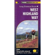
West Highland Way XT40 Map | Durable Waterproof Walking Map Milngavie to Fort William
Estimated Shipping Widget will be displayed here!
Description
The West Highland Way XT40 Map is a tough and reliable navigation tool designed for long-distance walking in all conditions. Covering the entire route from Milngavie to Fort William on a single sheet, it provides a clear and practical overview of the trail.
Built using virtually indestructible XT40 material, this map is designed to withstand heavy use, making it ideal for hiking in typical UK weather. Lightweight and compact, it fits easily into your pack or pocket without the need to carry multiple maps.
The clear and easy-to-read layout includes key route information, accommodation, and essential services along the way, helping you stay organised throughout your journey. A full multilingual key is included in English, French, and German, making it accessible for a wide range of walkers.
Key Features
- Covers the full West Highland Way on one sheet
- Tough XT40 material for long-lasting durability
- Waterproof and resistant to tearing
- Lightweight and compact design
- Clear and easy-to-read mapping
- Includes accommodation and service locations
- Multilingual key (English, French, German)
Specifications
- Route Coverage: Milngavie to Fort William
- Material: XT40 waterproof durable material
- Format: Single-sheet folding map
- Use: Hiking, navigation, route planning

Notified by email when this product becomes available

£18.95
